The Impact of Commercial Satellites on Modern Military Strategies
The rise of commercial satellites offers near real-time surveillance, prompting militaries to adapt their strategies for deception.
In-depth analysis
Natural phenomena
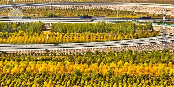
The rise of commercial satellite technology has marked a significant natural phenomenon in the realm of warfare and surveillance. These advancements allow for real-time imaging and data collection from space, fundamentally altering how conflicts are monitored and understood. The ability to capture high-resolution images from various locations multiple times a day represents a transformative shift in geospatial intelligence.
Impact on communities
Communities are increasingly affected by the transparency brought about by satellite technology, which provides immediate insights into military actions. This accessibility can enhance public awareness but also raises concerns about the implications of real-time surveillance on privacy and security.
Scientific updates
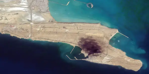
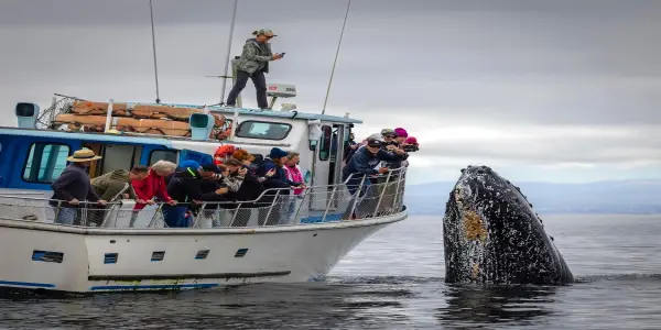
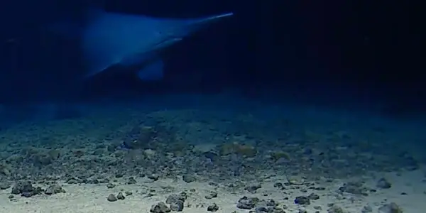
Recent developments in satellite capabilities have introduced advanced technologies that extend beyond simple imaging. Companies are now employing methods to detect various wavelengths and radio signals, enhancing the ability to monitor naval movements and military communications, particularly in strategically critical areas like the Strait of Hormuz.
Future outlook
The future of satellite technology suggests a continued evolution towards greater accessibility of geospatial intelligence. As military strategies adapt to these advancements, the potential for increased strategic deception and the challenges of information reliability will likely shape the geopolitical landscape.
Did you know?
Why this matters for our planet
The rise of commercial satellite technology transforms how we understand and respond to global conflicts. For everyday life, this means a higher level of transparency regarding international affairs and military actions, impacting public discourse and policymaking. Enhanced surveillance can aid in humanitarian efforts, ensuring that crises are documented and addressed promptly, ultimately influencing the trajectory of geopolitical stability.
Earth's undiscovered wonder
Did you know that a single commercial satellite can capture up to 15 images of the same location each day? This capability allows governments and organizations to monitor changes in environments, urban development, and even natural disasters in real-time, offering unprecedented insights that can drive timely interventions and policy decisions.
The voice of Earth
Marcus, 34, from Chicago, always had a fascination with space. As a child, he dreamed of being an astronaut. Now, he works as a data analyst for a nonprofit focused on climate change. Recently, Marcus used satellite imagery to track deforestation in the Amazon. Watching the data unfold in real-time, he felt a deep connection to the planet's struggles. 'It's like I'm witnessing history,' he said, realizing that each image represents a life lost, a habitat destroyed. This technology fuels his passion and determination to advocate for change.
Expert Commentary
Supercomputers Analyze Enceladus's Plume Dynamics
Geomagnetic Storm Forces Delay of Blue Origin's...

Exploring Iterative Creativity: Pelicans on...

Innovative Gel Shows Promise in Regenerating...

UK Churches Embrace Heat Pumps for Sustainable...
Aging Stars Pose Threat to Nearby Planets, New...

Intaaya Retreat in Indonesia Features Innovative...
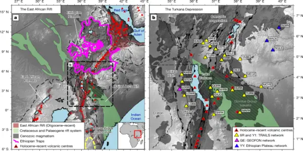
Insights into Lithospheric Dynamics from Turkana...

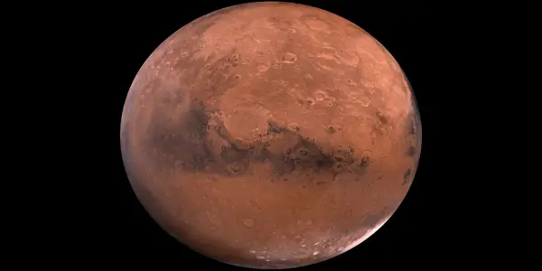
Time on Mars Outpaces Earth, Unveiling Challenges...

Ancient Crocodile Fossils Unearthed in Australia...

US Government to Halt SNAP Benefits Amid Ongoing...

Significant Geomagnetic Storm Unleashes Auroras...
The Challenges of Sending a Supervillain into the...

Catherine O’Hara, Iconic Actress from...
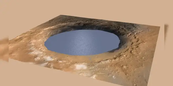
Ancient Lakes on Mars: New Research Unveils Ice...
Notable Aquatic Highlights from the 2025 Nature's...

Exploring the Nature of Intelligence: Insights...
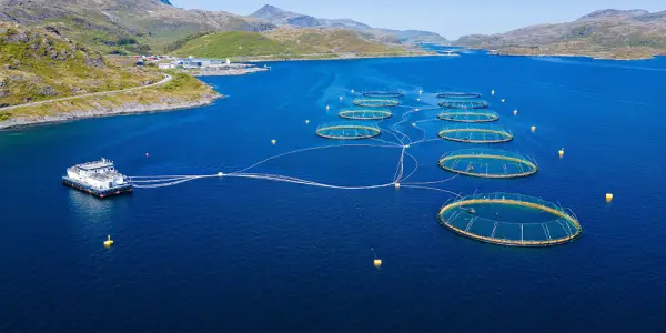
Reassessing the Impact of Farmed Seafood on Ocean...

Top Organic Mattresses of 2025: Birch, Avocado,...

New Ice Age Episodes of Prehistoric Planet Now...

Steven Spielberg Steps Back from Sci-Fi Series...
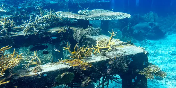
Understanding Artificial Reefs: A Solution for...

Innovative Architectural Designs Inspired by...

Innovative Technique Utilizes Dragonberry Weed to...
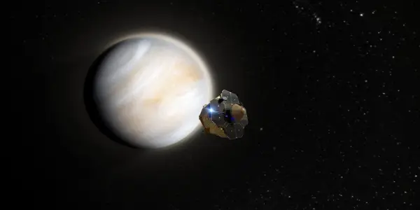
Upcoming Venus Missions Set to Explore Earth's...

Exploring the Depths of Nature: Boyd Varty's...

Johnny Keefer's Ascent Raises Questions About...

New Insights from the Butterfly Nebula May...
Reassessing Economic Growth: Valuing Natural...
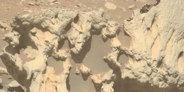
Perseverance Rover Discovers Unusual Rock Near...

Interstellar Comet 3I/ATLAS Reaches Perihelion,...

Exploring Key Questions Raised by ‘Avatar: Fire...

New Research Suggests Water Could Form During...
Study Reveals Fast Healing of Deep Earthquake...
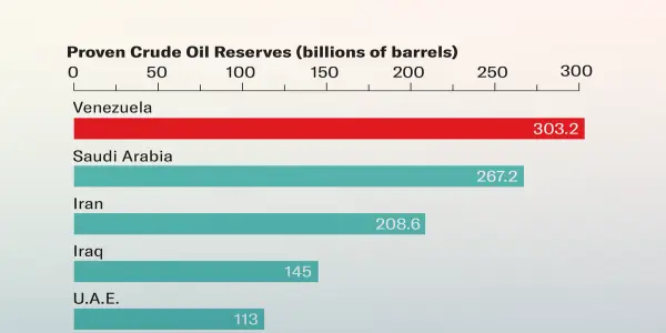
The Allure of Venezuela's Oil Reserves: Analyzing...
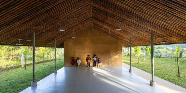
VTN Architects Completes Nuoc Ui School in...

Rammed Earth Homes of 2026 Showcase Sustainable...