Comprehensive 3D Map Showcases Every Building on Earth
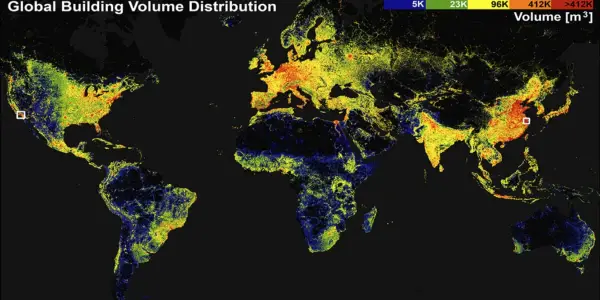
A groundbreaking 3D map by researchers at TUM reveals every building on Earth, enhancing geographic data visualization with unprecedented detail and accessib...
In-depth analysis
Current environmental changes
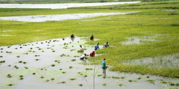
The Global Building Atlas reveals critical insights into urbanization patterns, showcasing how densely populated areas contribute to environmental changes. By mapping 2.75 billion buildings with high precision, the project highlights variations in urban density and building volume, allowing for better understanding of their impacts on local ecosystems and resource consumption.
Impact on society
This comprehensive mapping tool sheds light on socioeconomic disparities within urban areas, enabling researchers to analyze correlations between building density and community well-being, thereby addressing vital issues of poverty and urbanization.
Policy implications
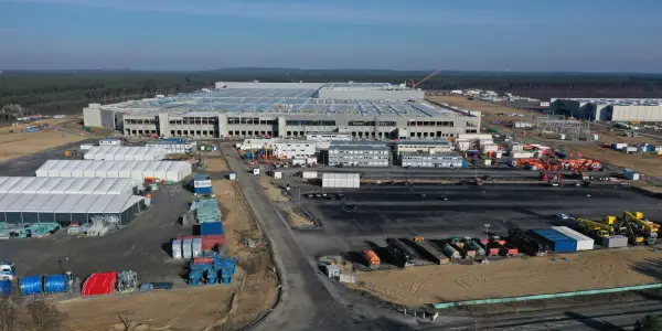
The Global Building Atlas serves as a vital resource for policymakers, offering data that can inform climate-related strategies and urban planning. Its detailed insights into building distribution can enhance risk assessments for natural disasters, guiding effective interventions in vulnerable regions.
Future outlook
As urbanization continues to accelerate, the Global Building Atlas is poised to play a crucial role in future research and policy-making. Its innovative approach sets a precedent for subsequent mapping initiatives, emphasizing the necessity of detailed geographic data in addressing global challenges.
Did you know?
Why this concerns all of us
The Global Building Atlas directly impacts urban planning, disaster response, and climate action, which resonate deeply in everyday life. For instance, city officials can now leverage precise data to allocate resources efficiently, improving local infrastructure and safety. Communities can better understand their urban environments, aiding in addressing inequalities and enhancing overall quality of life. This tool empowers both policymakers and residents to make informed decisions that shape their neighborhoods.
Nature's hidden secret
Surprisingly, nearly 30% of the world’s buildings are located in urban areas that are often overlooked in traditional mapping efforts. This means that vast swathes of urban structures in developing countries, which could significantly influence socioeconomic research, are now captured in unprecedented detail by the Global Building Atlas.
The person whose life climate changed
Meet Laura, a community planner in a small South American city struggling with rapid urbanization. For years, she faced challenges in addressing poverty and improving infrastructure due to a lack of reliable data. With the launch of the Global Building Atlas, Laura now has access to high-resolution maps that reveal the spatial dynamics of her city. This tool allows her to pinpoint areas with inadequate services and advocate for targeted investments. As she collaborates with local officials to implement data-driven strategies, Laura feels a renewed sense of hope. She envisions a future where her community thrives, using this information to create equitable urban spaces that cater to all residents, especially those who have long been marginalized.

The Resilient Desert Flora Thrives in Extreme...


£9 Billion Government Initiative to Revamp...
Projected Plastic Waste to Exceed 280 Million...
Comprehensive 3D Map Showcases Every Building on...

Doom's Programming Error Sparks Renewed Interest...

The Economic Risks of Abruptly Halting Solar...

UN Treaty for High Seas Conservation Now Effective

AI's Water Consumption May Soon Match That of 10...

Introducing the Clamshell Writer Deck: A Focused...
Ancient Ice Sample Reveals 6 Million-Year-Old Air...

Guide to Setting Up and Customizing Gemini Raise...

Revisiting India's Air Quality Standards Amid...

New Report Highlights Risks of Marine Carbon...
Global Climate Action in the Absence of the US: A...

Marvel Gears Up for a Major Avengers Event:...

Decline in Indian Passport Ranking Despite...

Revitalizing Wellness at Fairmont Chateau Lake...

Key Insights on the Future of Electricity Demand...

UK Prepares for Cold Snap with Snow Forecasts...

Puffins Make Historic Return to Isle of Muck...

The Crucible: A Test of Nerves in Snooker's Most...
Global Rice Yields Plummet Due to Extreme...

Tragic Cargo Plane Crash in Kentucky Claims Lives...

Top Five Books Exploring the Intersection of...

Key Insights Ahead of COP30 Summit in Brazil: A...

Pipeline Dispute Challenges Canada's Energy...
Lawsuit Alleges Tesla Wrongfully Terminated Deaf...

Cate Blanchett Joins Festive Guest Editors for...

New Lancet Report Reveals Alarming Impact of...

Hurricanes and Droughts: A Dangerous Connection...

Can New Alcohol Warning Labels Shift Ireland's...

Impact of Global Warming on Reptile Sex Ratios...

Reevaluating the Polar Bear Narrative Amid...

Residential ZIP Codes Linked to Increased...

Study Reveals Airborne Microplastics May...

Advocating for Forest Sovereignty: A Call for...

South Africa's G20 Agenda: Addressing Debt,...

Revival of Wild Turkeys: A Conservation Triumph...

The Impact of US Withdrawal on Global Climate...